How to reach
About the area
The setting is ideal – the focal point of the lake towns in the district
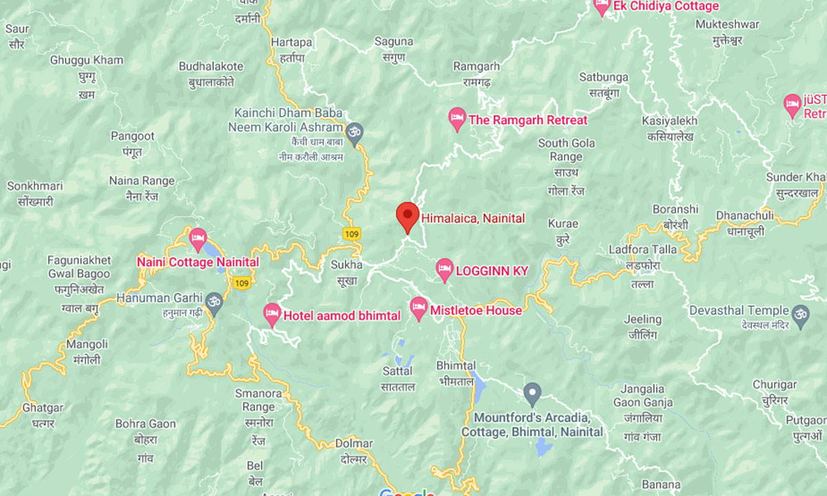
Only approx 10 kms away from Nainital, Bhimtal, Sattal and Ramgarh, close to all the essential support of a major town and yet quietly removed from the hustle and bustle.
Kumaon:
Kumaon is one of the two administrative and ethnic regions of the State of Uttarakhand, the other being Garhwal. Kumaon includes the Districts of Nainital, Almora, Bageshwar, Champawat, Pithoragarh and Udham Singh Nagar. It is bounded in the North by Tibet, on the East by Nepal, on the South by the State of Uttar Pradesh, and on the West by the Garhwal region.
Kumaon was originally a Rajput principality, which became extinct in the early 19th century, and later came to be ruled briefly by the Gorkhas of Nepal, till the region came under the control of the British in 1815.
The administrative headquarters of Kumaon Division is Nainital, centre of the “Lake District” of India. Nainital has historical and mythological significance, being mentioned in the Manas Khand of the Skanda Purana and also as one of the 64 Shakti Peeths. Nainital as we know it today came into being between 1839-1841 as a ‘European Colony’ established on the shores of a lake by an English businessman by the name of Barron. By 1847 it was a popular hill resort, and by 1862 it had become the summer seat of the North Western Provinces of British India.
Bhowali:
Latitude 29.38 degrees; 29° 22′ 47″ North Longitude 79.52 degrees, 79° 31′ 11″ East
Bhowali lay at one time on the bridle path from the plains of India to Tibet, and is today a key road junction in the region, with the roads to Haldwani, Nainital, Ranikhet, Almora, Ramgarh and Mukteshwar all meeting here. It is the perfect base to explore the region:
Haldwani: 40km Kathgodam: 35km Nainital: 11km Bhimtal: 11km Naukuchiyatal: 16km Ramgarh: 13km Mukteshwar: 48km Almora: 55km Ranikhet: 48km Sattal: 11km Dhanachuli: 40km Ramnagar: 65km
Today Bhowali is a well-known as a fruit ‘mandi‘ (marketplace and auction centre). The greater region also has a number of schools and educational institutions, and as a result the literacy rate here is high (80%). The population of Bhowali as per the 2011 census was just 5512.
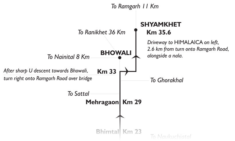
Village Shyamkhet
2.6 km on Bhowali-Ramgarh Road, Ramgarh Block, Nainital District, Kumaon Hills, Uttarakhand – 263 132
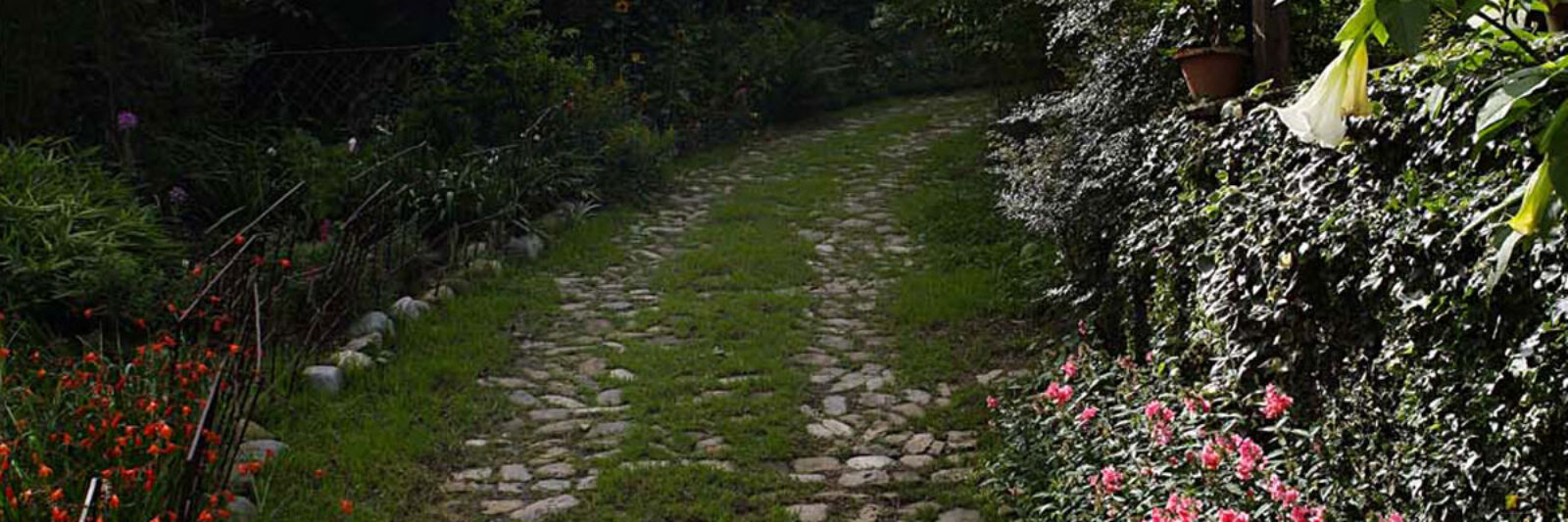
Himalaica is nestled in a crook between the tall hills on the Bhowali-Ramgarh road. A short drive up from the road leads to the Estate that is surrounded by Protected Forests to the East, North and West. Tall crags exist to the North, while there is a valley to the South. The forests are mixed – largely Oak and Pine, and birdlife abounds. Click here to see the complete list of the Birds of ‘Himalaica’ Region. Occasional sitting has occurred of leopard, Ghoral mountain goat, wild boar, fox, jackal and porcupine, barking deer, amongst other small wildlife such as pine marten, civet cat, weasels and non-poisonous snakes. The setting is, in fact, a significant watershed in the area and fresh-water springs that emerge from the Himalaica Estate feed the villages below. Seasonal nalas (seasonal streams) are located on either edge of the estate.
The driveway up to Himalaica appears on the left of the Bhowali-Ramgarh road, alongside a small ‘nala‘, precisely 2.6km from the turn-off over a small bridge as you enter Bhowali town from Bhimtal. The landmark for the drive up is a large white arched water tank to the left.
Shyamkhet village is located in the Ramgarh Block of Nainital District in the Kumaon Hills of Uttarakhand State. It is the last hamlet on the drive up to Ramgarh – thereafter the drive is through thick Reserve Forests.
